CLARKSVILLE, TN – When disaster strikes, two Austin Peay State University (APSU) employees drop everything to help coordinate an emergency response. Equipped with drones, data analytics skills and rapid mapping technology, APSU GIS Director Mike Wilson and Project Manager Doug Catellier provide local authorities with detailed damage assessments that would normally take days or weeks to compile.
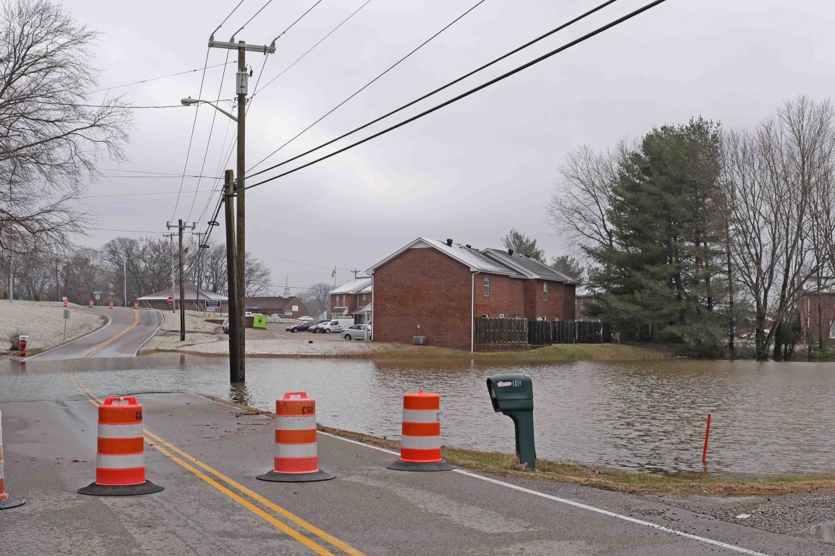
Within hours of the recent tornadoes devastating Montgomery County, the pair was in the skies and on the ground, surveying the wreckage and collaborating with emergency officials to target aid to the hardest-hit neighborhoods.
“On [Dec. 9], they called Doug in to fly drones,” Wilson said regarding coordination with local Emergency Management Agency (EMA) authorities. “I called to see if they needed help setting up the mapping and other things they would need to use.”
While Wilson organizes data at the Emergency Operations Center (EOC), his colleague pilots drones over disaster zones to capture aerial footage of collapsed roofs, uprooted trees and other devastation. The data is then compiled into interactive maps and databases pinpointing each damaged property.
“If they have cell phone connectivity, the people doing the damage assessment would go out with maps on their mobile phones and collect all the data,” Wilson said. “Once they submit, that damage assessment would hit the server at the EOC and update the dashboard.”

Real-time data crucial for aid response
Access to real-time damage data has proven invaluable for emergency personnel rushing to help.
“Because our dashboard was live when TEMA (Tennessee Emergency Management Agency) officials saw we had that, they wanted live access as well,” Wilson said. “[They] began getting near real-time updates of the damage assessments as they were being conducted.”
Rodney Grimsley, deputy director of the Montgomery County EMA, has witnessed a revolution in disaster response thanks to Wilson and Catellier’s rapid mapping and data compilation tools.
“What used to take days to do by pencil and paper, they crafted a good picture of the extent of the damage after a day and had a great picture shortly thereafter,” Grimsley said of their recent efforts.
The detailed property damage statistics and location data have allowed officials to direct their response to wherever it is needed most. According to Wilson, organizations across Montgomery County immediately used updated assessment maps.
“Our data was used by the school system to identify children who were in the path of the tornado, which was a significant number,” he said. “It was used for food distribution.”

Speeding up recovery efforts
Damage statistics are crucial in expediting federal disaster aid and assisting emergency response. After major storms, local authorities submit assessments to the Federal Emergency Management Agency (FEMA), which decides on emergency declarations. Detailed follow-up surveys help connect impacted residents with recovery assistance.
Wilson and Catellier’s tech-enabled legwork after the Montgomery County tornado proved pivotal in securing a federal disaster declaration to mobilize resources.
“The data we collect helps identify who’s in most desperate need and in what areas, and then helps get that aid to folks as quickly as possible,” Wilson said.
Grimsley agreed that rapid access to property assessments expedited the emergency declaration and will be invaluable for ongoing recovery programs.
“We had the worst damage in the state, and FEMA makes declarations based on dollar amounts,” he said. “The dollar amounts they were able to see early enabled that declaration, which gets money rolling in for the citizens and helps get reimbursement for government expenses. Thanks to these tools, all that came together much faster.”

Damage classification critical
Wilson and Catellier’s data sets are influential because they classify properties using FEMA’s coding system. Assessors categorize buildings as “affected,” “minor damage,” “major damage” or “destroyed” based on standardized criteria that FEMA incorporates into its disaster aid formulas.
The pair delivers response data organized to align with federal classification methodologies, providing information that emergency managers and FEMA can immediately use to direct resources.
“Montgomery County was one of the quickest counties in the state to get their data collected and put together,” Wilson said. “A lot of communities don’t have the resources to collect things quickly; there are a lot of data management tasks to be done. By collecting digitally, we can pass that data on much more quickly and share it between agencies.”